4 days hiking through the Upper Danube Nature Park
on the Donauberglandweg trail
Fantastic views – Unique landscapes – New discoveries every day
From the highest mountain in the Swabian Alb to the Upper Danube Valley
Ideal for a short vacation for hiking in the south
From the Albtrauf to the Danube valley –
4 days through the Donaubergland
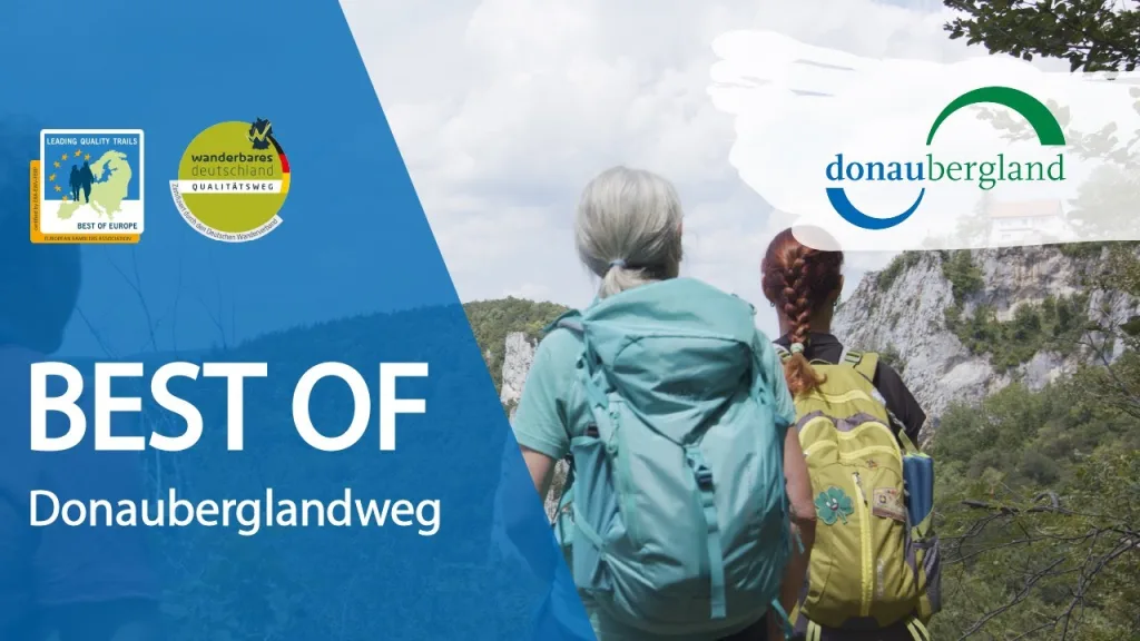
Impressions and pictures from the hike on the Donauberglandweg – a film team accompanied two hiking couples.
from the hike through the Donaubergland
The detailed stage videos, pictures, impressions of the tour and more
SWR-Film: 4 days on the road on the Donauberglandweg
The two SWR editors Diana and Sarah from the online channel “Outdoorliebe” spent four days on the Donauberglandweg trail in May 2025.
In the SWR television report (on June 19), they talk about their most beautiful experiences, personal experiences and the most important insights from their multi-day tour, long-distance hiking in their own homeland on the Donauberglandweg trail.
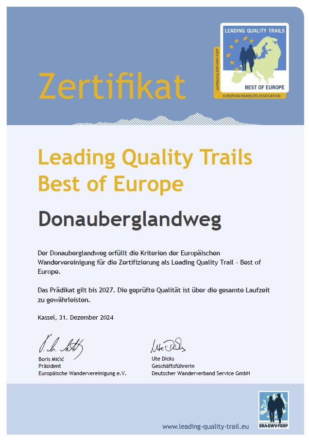
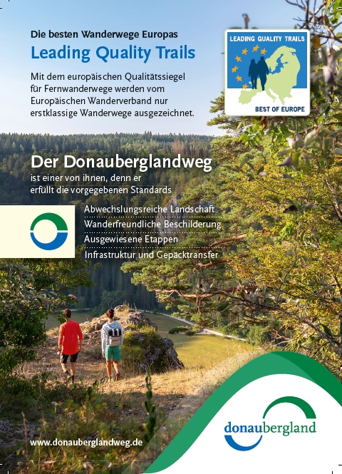
The Donauberglandweg
A Leading Quality Trail – Best of Europeone of over 20 leading quality tra ils in Europe.
Awarded by experts
In 2008, the Donauberglandweg was the first hiking trail in the Swabian Alb to be recognized by the German Hiking Association as a “Quality Trail Hikeable Germany” according to the then new tourist hiking criteria, successfully certified and awarded.
In the meantime, the route through the Donaubergland has already been tested six more times every three years and has been awarded the seal again each time.
In the fall of 2018, the Donauberglandweg was certified by the European Ramblers’ Association and the German Hiking Association for the first time as a “Leading Quality Trail – Best of Europe” award. It has thus been promoted to the European premier class of hiking trails. The award will be presented for the third time in January 2025.

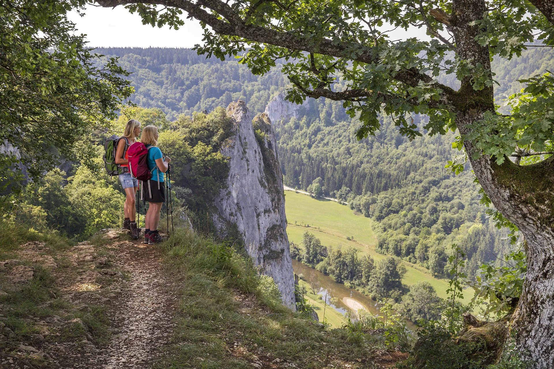
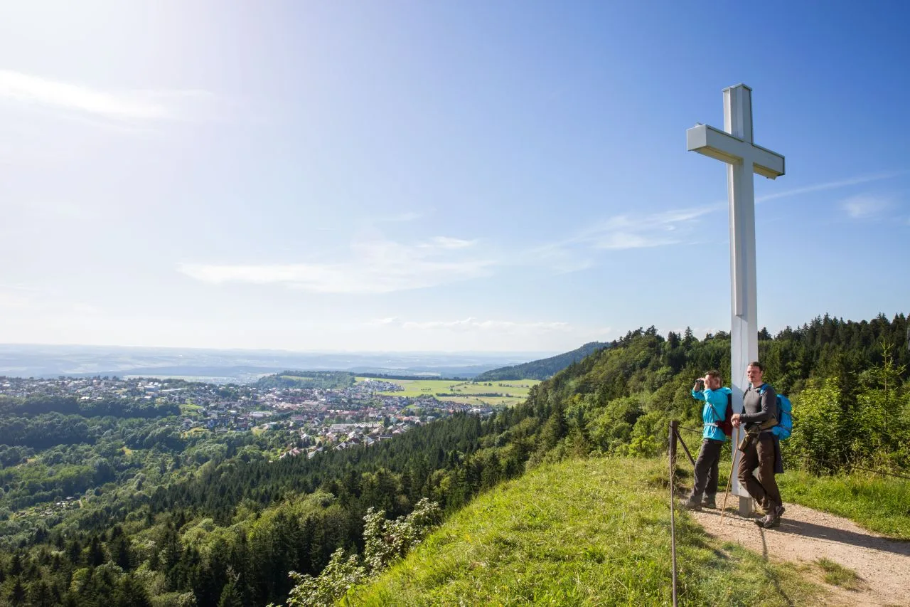
From the roof of the Swabian Alb to the Danube valley
Four day stages from the “Region of the 10 Thousanders” to the Upper Danube Valley – from the highest mountain in the Alb, the Lemberg near Gosheim, to Beuron in the valley of the Young Danube, the “Swabian Grand Canyon”.
The Lembergwith its 1015 meters the highest mountain of the Swabian Albis the starting point of an excellent 60-kilometer hiking trail. The Beuron Monastery is the destination of the hiking tour. Four days of changing scenery in the Upper Danube Nature Park.
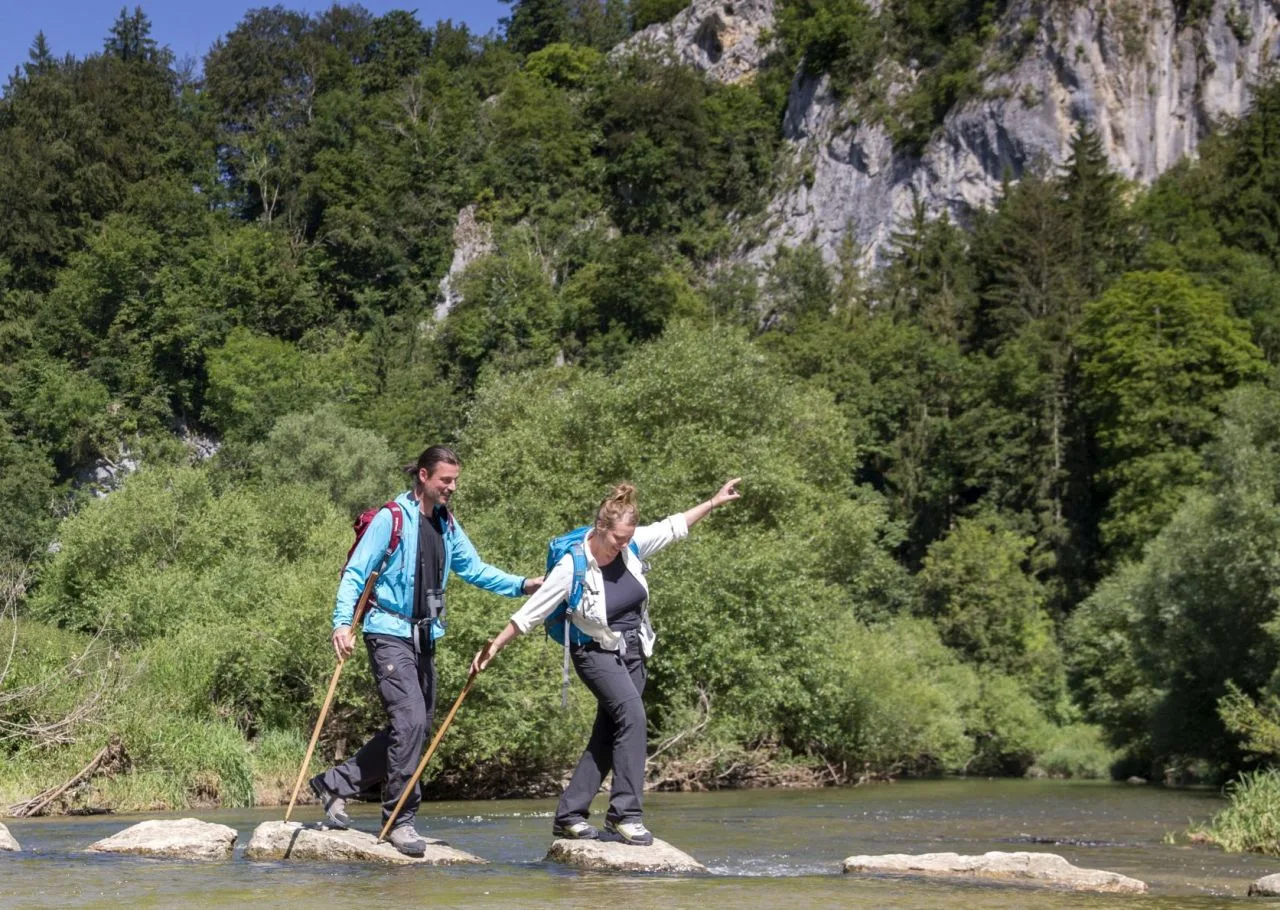
Covering an altitude difference of over 3,200 meters with ascents and descents, the trail leads in four stages of around 15 to 20 kilometers each through the most beautiful landscape of the south-western Alb. Almost half of the trail runs along natural paths and romantic footpaths.
Along the Albtrauf on the southwest Alb, the route descends to the Danube towns of Mühlheim and Fridingen as far as Beuronthe world-famous abbey town and center of the Upper Danube Upper Danube Nature Park.
Our stage recommendation
We recommend that you hike the Donauberglandweg in 4 daily stages. This means that the four stage towns are the best places to stay overnight and stop for refreshments. The stages would then each be between 15 and 20 kilometers long.
Of course, you are also welcome to choose a different route or hike the Donauberglandweg in two or three days.
You can also hike the individual stages on day trips and travel from the end point of each stage by bus or train back to the start.
We will be happy to advise you.https://www.donaubergland.de/tipps-und-hinweise-zum-donauberglandweg/
Tips and information for your tour on the Donauberglandweg
Good to know – Our tips for your tour.
Enjoy well-planned hiking days in the Donaubergland –
We will be happy to advise you.
2025:
At night in the SOUTH:
Sunrise on the Donauberglandweg
Themed year 2025 Tourism Baden-Württemberg
We are a partner region of the Swabian Alb
The Donauberglandweg as a Leading Quality Trail
Hiking without borders. Hiking connects.
As a Leading Quality Trail, the Donauberglandweg is part of a European “hiking community”.
But what is a “Leading Quality Trail” and which long-distance hiking trails in Europe are included?
By the way, the Donauberglandweg is “washed” by Danube waves.
The Donauberglandweg is connected to our DanubeWaves – premium trails as day tours.
The DonauWellen premium trails “wash around” the Donauberglandweg directly along the path (Klippeneck Climb, Danube Rocks Tour, Eichfelsen-Panorama) or in the immediate vicinity (Kraftstein-Runde, Old Shepherd’s Trail, Danube sinking).
How about,
Extend your hiking break in the Donaubergland a little longer and add on one of the DonauWellen day tours, such as the DanubeWaves Eichfelsen-Panoramaat the end of the Donauberglandweg in Beuron?
Important information about the tours
To make your hikes as relaxed as possible, you will always find all current closures, detours and information at a glance
FAQ
Answers to the most frequently asked questions about the Donauberglandweg
How is the route signposted?
The Donauberglandweg is signposted and marked throughout in both directions according to the quality criteria of the German Hiking Association. Yellow signposts indicate the next destinations and distances. Along the way, the route is marked with its own signpost (green-blue circle)
Do I need a hiking map?
A hiking map is not absolutely necessary, as the Donauberglandweg is marked as a certified “untravelled” quality trail. A map can be helpful to get from your overnight accommodation to the start of the next stage. However, the access routes are described in detail in the pocket guide “Der Donauberglandweg”. Small hiking maps for the individual stages can also be found in the brochure.
If you still feel safer with a map, we recommend the following editions available in bookshops:
- Leisure maps 507 (Upper Danube Nature Park No. 1, Villingen-Schwenningen, ISBN 978-3-89021-600-3) and 526 (Upper Danube Nature Park No. 2, Sigmaringen, ISBN 978-3-89021-619-6), in a double pack, scale 1:50 000
- KOMPASS hiking map781, Upper Danube Nature Park – Albstadt – Tuttlingen – Sigmaringen
(folded), hiking map with active guide and cycle routes. GPS-accurate. 1:50 000, weatherproof, tearproof
ISBN/EAN: 9783850269025
Can I also walk the Donauberglandweg in the opposite direction?
In principle, yes, because it is perfectly signposted in both directions. For dramaturgical reasons, however, we recommend walking from the Albtrauf in the north to the Danube valley in the south.
Do I have to book the accommodation in advance?
It is generally safer to book accommodation in advance and not on the day of the hike. On particularly busy long weekends (with bridging days) there may be bottlenecks. Booking in advance also gives you more choice when it comes to finding suitable accommodation.
Can I also camp on the Donauberglandweg?
Unfortunately, no. There are no campsites along the Donauberglandweg.
Motorhome sites near the trail are located in Gosheim and Beuron.
What is the best time of year?
The Donauberglandweg is best accessible between May and October, and in good weather until mid-November. From November to April, the trail is closed for the winter, i.e. it is not maintained. The purpose of the winter break is to maintain the trail as well as possible and to protect nature. In addition, some sections are difficult to walk on in the wet season. There is a risk of slipping on the steep, rocky and natural sections and the path cannot be cleared in snow and ice.
Can I bring my dog with me?
In some accommodation establishments it is permitted to bring dogs. This is marked with a pictogram in our host directory. Nevertheless, it is advisable to ask again when booking to be on the safe side, especially if it is a large dog.
In Baden-Württemberg there is no leash requirement, provided that you have your dog safely under control and can easily call him back if necessary. Nevertheless, we ask that you keep your dog on a lead when you meet other people, especially children, as well as wild animals.
Can I also ride my mountain bike on the Donauberglandweg?
No. The Donauberglandweg is a hiking trail that has many narrow, natural sections. This can lead to conflicts with hikers. In addition, the 2-metre rule applies in Baden-Württemberg, which prohibits cycling on paths less than two meters wide.
How challenging is the Donauberglandweg?
The stage lengths, including access routes to/from stops and/or overnight accommodation, are between approx. 14.5 and 22.9 km. There are usually a few meters of altitude to overcome, and
surefootedness is definitely required. You should bring some stamina with you, especially if you walk all 4 stages on 4 consecutive days.
Is the Donaubergland Trail also suitable for children?
Even children who enjoy walking and are used to hiking can manage the Donauberglandweg. There are plenty of places to rest and barbecue along the way where you can enjoy a break.
Is the route also feasible from a stationary accommodation?
If you don’t want a new accommodation every day, you can also reach the individual stages daily by public transport. Information on how to reach the starting points can be found at www.bahn.de and at www.mein-move.de (regional bus services), or at www.efa-bw.de.
How do I get back to my car?
From the destination in Beuron, trains leave for Tuttlingen approximately every hour. There you have a connection to the train to Aldingen. If necessary, take the 220 bus from Aldingen to Gosheim, depending on where you have parked your car.
How long does it take to get back to the car from the end of the path?
The return journey by public transport to the starting point in Gosheim takes approx. 2 hours and is only possible until shortly before 6 pm. We therefore recommend leaving the car in Aldingen on arrival and taking the bus to the starting point in Gosheim on the first day of the hike. The return journey to the end point of the Donaubergland Trail in Beuron is then shorter and also possible until shortly before 8 pm.
Do you have any further questions?
Then please contact us.
Newsletter
Do you want to keep up to date with the latest news from the Donaubergland? Then sign up now for our newsletter.

AlbCard
By the way, absolutely attractive: the AlbCard – the guest card for the whole of the Swabian Alb – is also available from selected businesses in the Donaubergland.