The fascination of Danube infiltration
The Danube seepage is a unique natural spectacle!
Where does the Danube, this special river in Europe, flow to?
Why is the Danube infiltration system so unique?
The Danube does not (only) flow into the Black Sea!
Something quite extraordinary takes place in the Donaubergland: between Immendingen and Fridingen, the Danube divides: part of the Danube water sinks into the ground, while the other part – mostly – continues to flow above ground.
This applies:
The Danube flows into two seas – the Black Sea and the North Sea at the same time!
Is Vienna on the Danube?
Yes and no. Mostly. Still.
Black to black: From the Black Forest to the Black Sea. That’s how we learned it. And as the “Beautiful Blue Danube”, it flows wonderfully through Vienna.
But wait: the Danube is disappearing in the Donaubergland! In the summer months, it often disappears completely. At most, some Danube water can still reach the Danube seepage at certain water levels through the two detour tunnels near Immendingen and Fridingen. Danube seepage seepage. Sometimes nothing more. Then, if you like, Vienna is no longer actually on the Danube – but on the Krähenbach from the Tuttlingen district of Möhringen, the first tributary after the first full sinkhole!
Danube infiltration: What you should know
If you are planning an excursion or tour to the Danube seepage, you should consider the following in advance:
- The Danube can appear differently every day in the Danube seepage area between Immendingen, Möhringen, Tuttlingen and Fridingen in the Donaubergland:
Sometimes the Danube is full of water, sometimes it is completely dry in different places, sometimes there is a little water. - The water level of the Danube in this area is heavily dependent on the amount of rainfall in the Black Forest:
One or two days after the rainfall in the Black Forest, this has an effect on the level of the Danube. - The most interesting and best way to see the phenomenon of Danube seepage is a few days after the rain in the Black Forest has stopped, i.e. when the water in the Danube in the area of the Danube seepage becomes less and less and the Danube gradually dries up.
- Take a conscious decision to go on a hike, a walk or a bike ride in nature to the Danube infiltration site and enjoy it for yourself, either way, whether you see a lot on the day or whether you see less.
Our tip for orientation:
The web app for Danube infiltration
As part of the joint project “Fascination Danube Seepage” we have also developed a new web app in collaboration with the agency TourComm Germany agency.
It provides the most important information and tips on the Danube seepage. These will help you to find traces at the individual locations and to find your way along the entire Danube seepage from Immendingen to Fridingen and Aach in Hegau.
Open the app:
Please simply click on the following button
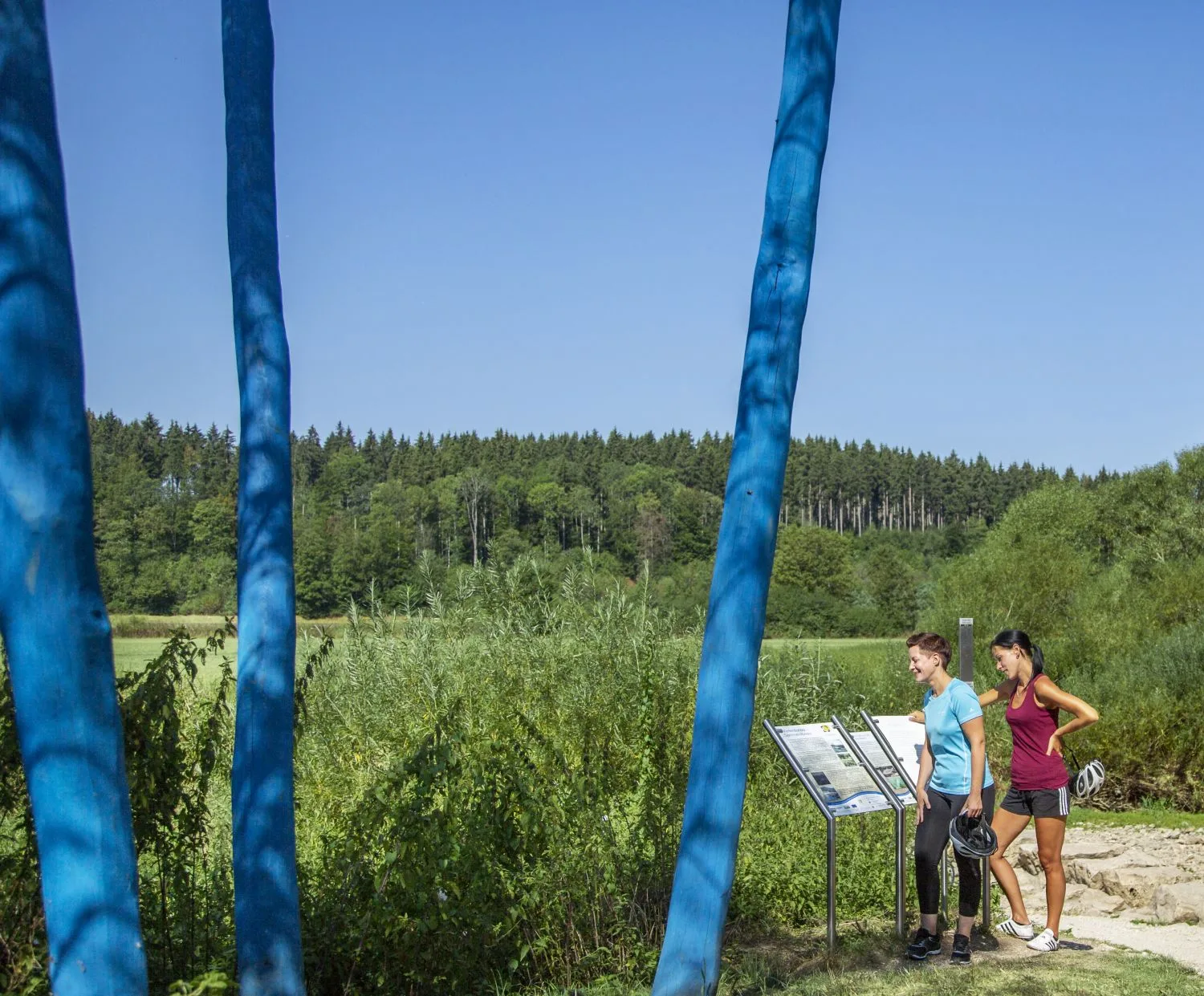
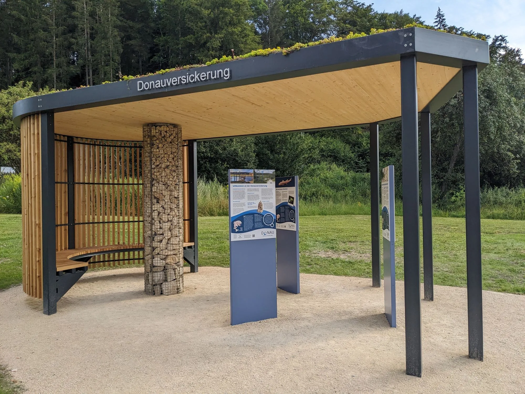
The Danube infiltration info points
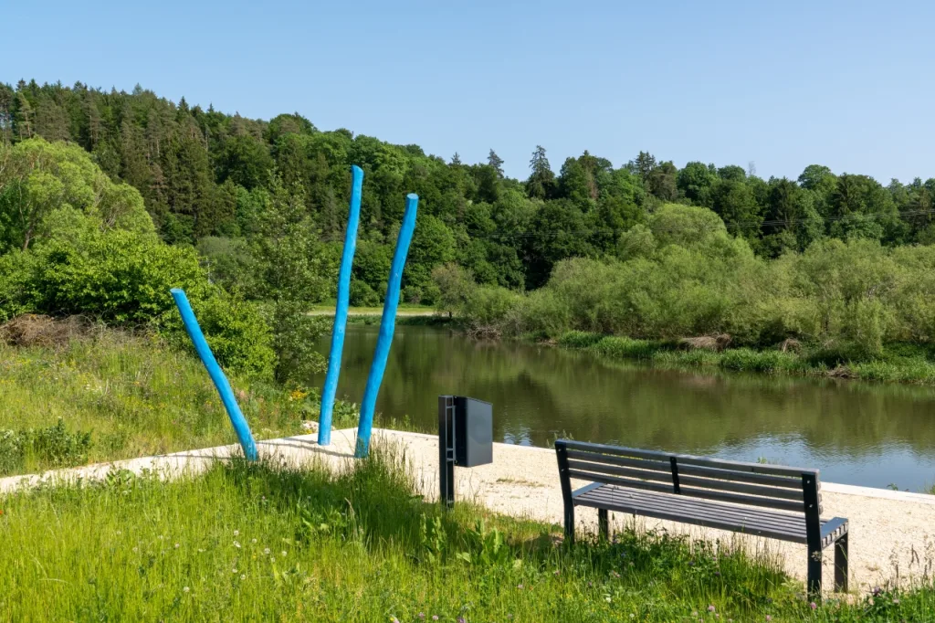
You will find covered pavilions as information points on Danube infiltration at three locations, near Immendingen, in Möhringen and near Fridingen, directly along the Danube cycle path. They were also built as part of the joint project “The fascination of Danube seepage” and opened in July 2024.
There you will find answers to the most important questions about Danube infiltration.
What do we particularly recommend?
So you can discover the Danube seepage yourself at the most important places.
But you can’t just drive straight there and want to “have a quick look”. No, the Danube seepage doesn’t make it easy. The most impressive natural sites should be discovered on foot or by bike. You can take shorter walks or longer hikes or cycle tours.
Discover the Danube seepage on hiking and cycling tours.
The Danube seepage can be seen in numerous places – but in very different ways in each case. You can go to the main seepage points near Immendingen or to the Danube ford between Immendingen and Möhringen. You can cycle to the main sinking point near Fridingen on the Danube cycle path, for example. You can visit the source of the Aach, the Krähenbach valley or the sinkholes and caves in the forest and much more.
But: it’s best to be prepared and have some prior knowledge. Then you may discover something surprising.
Some of our hiking tours and some cycling tours will take you to the most important places. Above all, you can experience the extraordinary landscape along the Danube, in the Danube valley and in Hegau – regardless of what you can see of the Danube seepage on a particular day.
Whether along the Danube Cycle Path, on one of our premium trails along the Danube, on local circular routes or the selected Donaubikeland tours – that alone is a pure Danube experience.
The most frequently asked question: Where does the Danube disappear?
This is unique in the world!
In the south-west of Baden-Württemberg, in the triangle between the Swabian Alb, the Black Forest and Lake Constance, precisely in the Donaubergland between Immendingen and Fridingen in the Danube valley, the Danube simply disappears into the ground.
Danube seepage does not only occur locally at one point, but at numerous points in this region: it is a regional event.
But, and that’s the special thing: The water from the Danube reappears! South of the Danube seepage, in the Aach spring. And in a completely different river system, namely the Rhine.
Where can you see the Danube seepage?
The Danube is sinking in several places in the Donaubergland. This can best be seen at the main sinking points between Immendingen and Tuttlingen-Möhringenpartly in Tuttlingen and also near Fridingen.
But what you can see also depends on the right time. And, you should know where you can best see something.
The disappearance of the water is most impressive to observe in the summer months – and then preferably a few days after heavy rainfall. In dry phases, it looks completely different again.
You can also easily register via the new Danube infiltration web app and find your way around. The individual locations (POIs) and their coordinates are shown on the map.
When will the Danube between Immendingen and Möhringen dry up?
Experience the Danube at full sinking
It is not so easy to catch the right moment to experience a full seepage and, above all, the transition from a full river to a dry riverbed. The seepage of the Danube changes almost daily, especially at different times of the year. This must be taken into account. It is therefore important to plan the tour in advance.
Tip: Orientate yourself at the Danube level Kirchen-Hausen.
At Kirchen-Hausena district of Geisingen up the Danube immediately before Immendingen, maintains the Flood Forecasting Center Baden-Württemberg (HVZ) of the Baden-Württemberg State Institute for the Environment maintains a measuring station. Here, the water level of the Danube is permanently measured and displayed online.
If the discharge of the Danube at this gauge measures a maximum of 6 – 8 cbm of water per second for a longer period of time, then it can be assumed that the Danube will dry up after the first main sinking points near Immendingen. This is because up to 8 cbm of water per second disappears into the ground at the main sinking point near Immendingen when there is sufficient water. That is 8000 liters per second!
All in all, this means that when less water arrives, it all disappears into the perforated riverbed. If more water arrives than can normally sink and seep away, some of the water continues to flow above ground.
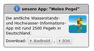
Tip:
You can also download the “Meine Pegel” app from the Baden-Württemberg Flood Forecasting Center for your smartphone from the App Store. There you will also find all the latest data for all Danube gauges.
Note on the website of the Flood Forecasting Center Baden-Württemberg:
Television tip:
SWR television reports on the Danube seepage
On the occasion of the opening of the info points, SWR television reported on the Danube infiltration in a short report in the program Landesschau Baden-Württemberg on July 31, 2024.

The Danube seepage:
A river disappears and reappears
The “Black Danube”
The Danube is a strange river, especially on its first stretch.
Where does the Danube originate?
First of all, it is easy to argue about where exactly the Danube has its source or where it actually originates. In Furtwangen in the Black Forest at the source of the Breg? Or is the source of the Danube near Donaueschingen? or both?
And why is the Danube disappearing in the Donaubergland?
Yes, no sooner has the Danube found its way past Donaueschingen than it does something unique in the world: the Danube splits and flows into two oceans.
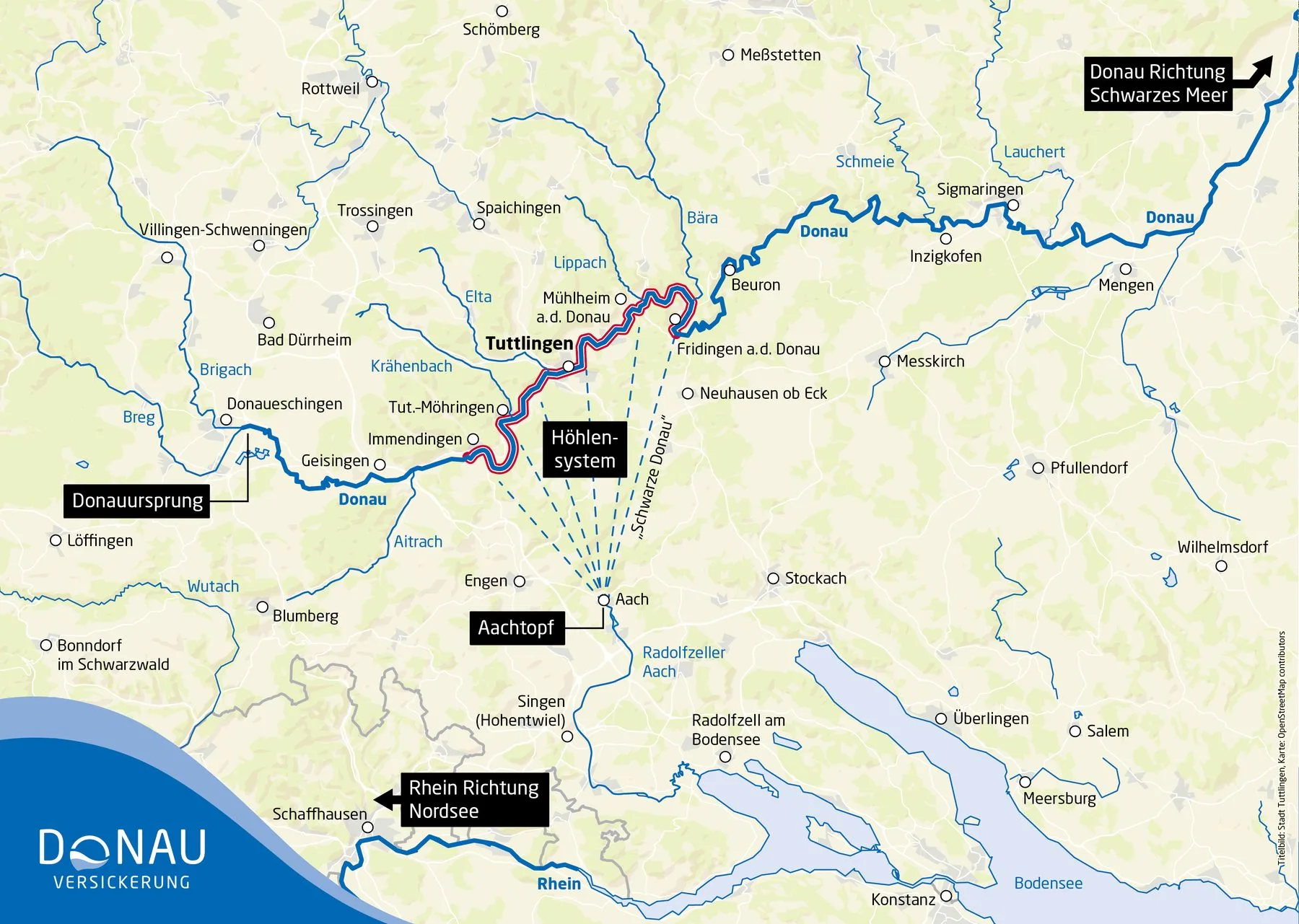
Near Immendingen and Möhringen a large part of the Danube water simply sinks into swallow holes. Also afterwards in Tuttlingen and beyond Fridingen in the Danube valley, there are further sinkholes and seepage points. The Danube water that flows off above ground, on the other hand, ends up in the Black Sea at some point on its 2800-kilometre journey. Black Sea Black Sea.
The part of the Danube water that disappears and flows underground finds its way south. And then, after three days, the Danube water emerges in the Aach spring (also known as the “Aachtopf”) in Hegau.
From there, the Danube water flows via the Radolfzeller Aach into the Lake Constanceand from there with the Rhine into the North Sea.
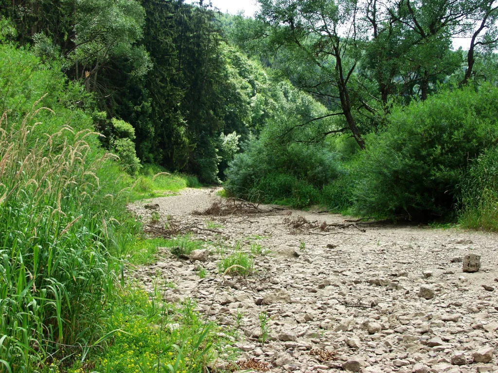
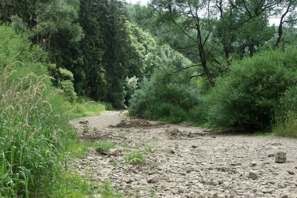
More and more frequently, the Danube riverbed is completely dry in summer, in some years for almost 200 days a year. The Danube then disappears completely underground.
You could also say: “Vienna is no longer on the Danube, Vienna is on the Krähenbach“‘. This is because the Krähenbach is the first tributary after the large seepage point. It flows into the Danube bed at Tuttlingen-Möhringen.
Why does the Danube water seep away?
The limestone of the Swabian Albwhich the Danube meets coming from the Black Forest near Immendingen, is becoming increasingly fissured. Here on the edge of the Swabian Alb between Immendingen and Fridingen, however, the shifts in the geological layers and the different composition of the layers of the Alb and Hegau or the Lake Constance region and Alpine foothills also play a decisive role in why the Danube sinks here on a large scale.
What’s more, in the long term, the Rhine is literally taking water away from the Danube! This is because the Rhine ditch and therefore the catchment area of the High Rhine, which was formed later than the original Danube system, is lower than the Danube system. Clearly, the water flows downhill and therefore prefers to flow in this direction.
An exciting performance!
The battle for water –
amazing stories about the Danube seepage
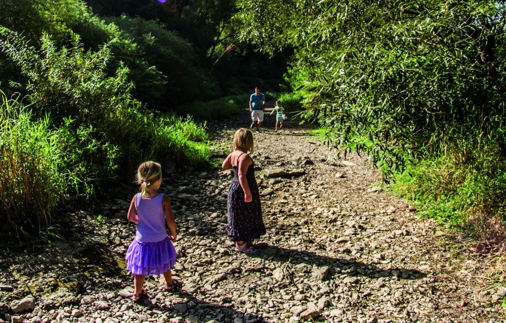
In summer, the riverbed is dry for weeks on end. You can walk dry on the Danube Wave Premium Trail Danube sinking through the Danube.
But doesn’t that also mean that in summer Ulm , Passau and Vienna not on the Danube, but perhaps on the Krähenbach? Because this is the next tributary of the Danube after the sinking near Möhringen.
Leaflet on Danube infiltration
with overview map for download
Sensation in the “Black Danube“
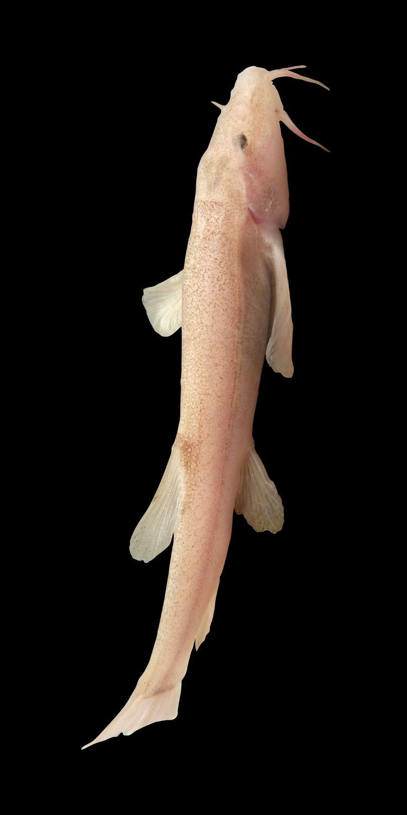
The first cave fish in Europe
Another natural wonder!
And, again, it has something to do with the Danube seepage:
In the huge underground caves and passages, in the “Black Danube“, underground between the Danube seepage and the source of the Aach, are home to cave fish. They were first discovered by cave divers in 2015. A real sensation!
More information about the sensational cave fish in the Danube seepage:
More about the sensational cavefish
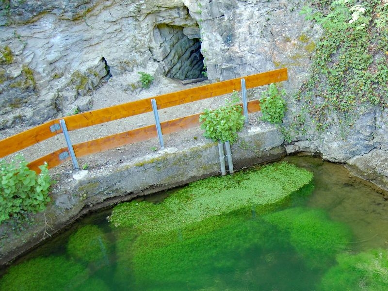
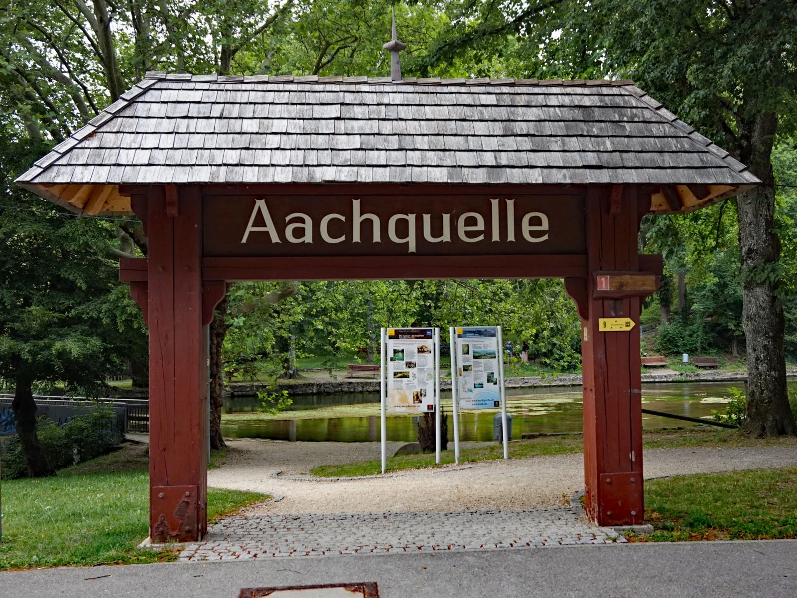
The source of the Aach
The “Aachtopf” near the small town of Aach in Hegau is the spring with the most water in Germany. It forms a small, shimmering green lake right in Aach.
However, the amount of water varies greatly depending on the season and rainfall. Up to 24,000 liters of water per second can rise from the spring cave, which is around 18 meters deep. A good two thirds of the water probably comes from the Danube, the other third from other springs, streams and rivers in the surrounding area.
Experience the Danube infiltration with the experts
The Danube seepage has exciting stories in store for you. Our trained “Danube Guides” are the best people to tell you these stories.
Let us take you to the mysterious places of the Danube seepage.
The trained and certified tour guides along the Danube are the experts, as they will take you to the best places and explain the impressive history of the Danube’s development in detail.
The Danube Guides
European network of certified tour guides along the Danube
Guided tours can either be booked directly with the Danube Guides or at the Tuttlingen Tourist Information Office and the Immendingen Citizens’ Service.
Our literature tips
If you want to delve deeper into the secrets of this unique phenomenon, we have a few literature recommendations for you.
These are also the basis for the key findings that we have compiled for you here.
Books and scientific works by experts
Approach
Arrival by bike via the Danube cycle path
At the end of Immendingen, follow the Danube cycle path in the direction of Tuttlingen. You can access the sinking sites either via the parking lot (see above) or approx. 1.5 km further down the Danube (to the left of the Danube) directly from the cycle path.
Arrival by bus and train
You can reach Immendingen, Möhringen, Tuttlingen and Fridingen by train and bus. The main sinking points are within walking distance of the train stations.
All of these towns are located on the Danube Valley Railway between Donaueschingen and Ulm. Tuttlingen is also on the Gäubahn (Stuttgart-Singen-Zurich). Immendingen is also on the Black Forest Railway (Offenburg – Villingen – Singen).
On-demand bus services at the weekend
You can book your bus trip in advance.
Directions by car from Immendingen or Tuttlingen
Coming from Immendingen, turn right at the end of the town in the direction of Tuttlingen (Unterer Ösch) and continue to the parking lot (at “Nina’s Ess-ART“) and continue to the parking lot. From the parking lot, you can follow the hiking trail (Premiumweg Donauwelle Donauversinkung) along the Danube to the sinking site. At the parking lot there is a special refreshment stop and a campsite for cyclists.
Coming from Tuttlingen, turn left at Möhringen on the B 311 towards Hattingen. The parking lot is located at the railroad bridge. Here you can learn more about the Danube seepage from the information boards.
Magazine
News on Danube infiltration
Our recommendations
for hiking and cycling tours
Fascination Danube Seepage – A joint project by:
Coordinated by:
Newsletter
Do you want to keep up to date with the latest news from the Donaubergland? Then sign up now for our newsletter.

AlbCard
By the way, absolutely attractive: the AlbCard – the guest card for the whole of the Swabian Alb – is also available from selected businesses in the Donaubergland.